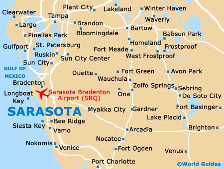
Sarasota Bradenton International Airport (SRQ)
Orientation and Maps
(Sarasota, Florida (FL), USA)
The biggest city in this part of western Florida, Sarasota has a population of more than 50,000 and an important arts scene. With many nearby beaches and waterfront locations, Sarasota is popular all through the year, with especially warm winters.
Close to Bradenton and on the northern side of the city, Sarasota Bradenton Airport (SRQ) serves both the Sarasota County and Manatee County. The airport is fairly small and despite its size features some of America's largest airlines.
Sarasota Bradenton Airport (SRQ) Maps: Important City Districts
Close to Sarasota, the Lido Key lies to the west, across the bay and connected by the US-789 (John Ringling Boulevard), which passes the Bird Key along the way. Within Sarasota itself, the downtown area is full of action, being home to many thriving art galleries and top dining venues.
Downtown Sarasota is known for its mixture of old and new, with a number of historic buildings being located in this part of the city. Sarasota is home to many important sites that are now listed on a register, including the American National Bank Building, the County Courthouse and the Overtown Historic District, which is based around Cohen Avenue and Central Avenue.
To the north of Sarasota, the Longboat Key area is a popular island with impressive beaches. Located on the northern side, Greer Island Park is amongst the top attractions in this area. Other notable districts around Sarasota include the Lido Key, Longboat Key and Oyster Bay.
USA Map

Florida Map

Sarasota Map